


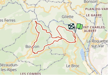

16 km | 29 km-effort


Usuario GUIDE


Aplicación GPS de excursión GRATIS
 SityTrail
IGN / Institutos geográficos
SityTrail World
El mundo es suyo
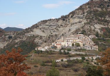
Ruta Senderismo de 19,1 km a descubrir en Provenza-Alpes-Costa Azul, Alpes Marítimos, Le Broc. Esta ruta ha sido propuesta por jouans.
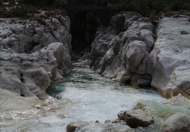
Les Iscles Bouyon par la Chapelle Ste Marguerite - Les gorges de l'Esteron Chapelle Ste Marguerite Les Iscles
REV 24/01/2024 Gilles
A pie

Senderismo

Senderismo

A pie

A pie
A pie

Senderismo
Senderismo

Senderismo